Weather
Mild and Dry Weather Stretch Ahead for Bennington County: Highs to Reach Upper 50s
Bennington County is set for a mild, dry weather stretch through Saturday, featuring zero percent chance of rain or snow. Daytime temperatures will reach the upper 50s with smooth travel conditions across US-7, VT-279, and the Molly Stark Trail.



Last updated:
Current Conditions in the Bennington Valley Bennington County weather forecast
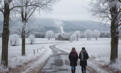
Good morning, southwestern Vermont. We are waking up to a calm and clear sky across Bennington, with the current temperature standing at a crisp 36.2°F. Winds are light and gentle across the region at just 3.8 mph, making for a pleasant start to the day. There are currently no active weather alerts, watches, or warnings for Bennington County or our surrounding communities, including Old Bennington, North Bennington, Shaftsbury, Pownal, Woodford, and Arlington. Overall, a quiet, dry, and surprisingly mild late-November stretch of weather is settling into the region for the next several days.
Three-Day Detailed Forecast Breakdown
Our upcoming weather pattern is dominated by stable conditions, bringing a zero percent probability of precipitation and zero measurable rainfall or snowfall through at least Saturday. Here is what you can expect day by day across our valley and mountain towns:
Thursday, November 19, 2026
Cloud cover will increase as the day progresses, turning overcast. Despite the cloudy skies, daytime temperatures will climb well above seasonal averages for late November, reaching a high of 54.3°F. Winds will remain light, topping out at a maximum speed of 9.0 mph. Overnight into early morning, temperatures will dip to a low of 32.4°F, hovering right around the freezing mark. With zero percent chance of precipitation, roads will remain dry, though localized frost is possible in chilly valleys.
Friday, November 20, 2026
Overcast conditions will persist through Friday, but the mild air mass stays firmly in place. Expect an afternoon high temperature of 55.2°F. Wind speeds will peak slightly higher than Thursday, reaching a maximum of 11.6 mph, which remains manageable across the area. The notable shift on Friday comes overnight: cloud cover will hold warmth near the surface, keeping overnight lows down to a mild 40.3°F. This will prevent any freeze or black ice concerns across local roads.
Saturday, November 21, 2026
The weekend begins on a bright note as overcast skies break up, yielding partly cloudy conditions. Saturday will feature the warmest temperature of the stretch, with afternoon highs topping out at a delightful 57.7°F. Winds will diminish significantly, with maximum speeds reaching just 4.5 mph. Overnight temperatures on Saturday night will settle at 38.9°F under partly cloudy skies, remaining safely above freezing.
Commute Impacts and Travel Conditions
For drivers traversing primary travel corridors such as US-7, the VT-279 bypass, or commuting over the Molly Stark Trail (VT-9) toward Woodford, travel conditions look remarkably smooth. Because precipitation probability is 0% each day with 0.00 inches of rain or snow predicted, winter weather hazards like slush, snowpack, or heavy rain are absent. Drivers embarking early Thursday morning should stay mindful of localized frost due to the 32.4°F low, but dry road surfaces mean black ice risk is minimal. Peak winds capped under 12 mph will also ensure stable driving conditions over higher-elevation passes.
Outdoor Recreation and Mountain Conditions
If you plan to get outdoors before the true onset of winter cold, this three-day window offers ideal conditions across Bennington County. Hikers visiting Mount Anthony, trails within the Green Mountain National Forest, or those taking a quiet walk around Lake Paran in North Bennington will enjoy comfortable afternoon temperatures ranging from 54.3°F to 57.7°F. Light wind speeds—maxing out at 11.6 mph on Friday and dropping to 4.5 mph on Saturday—will keep mountain wind chills non-existent. Without rain or snow in the forecast, trail conditions remain dry and steady.
Sensible Living and Seasonal Context
Late November in Vermont often brings heavy freeze cycles, early snow flurries, or ice, but this forecast provides a welcome reprieve. The mild daytime highs in the mid-to-upper 50s and overnight lows staying mostly above freezing (32.4°F, 40.3°F, and 38.9°F) offer a great opportunity to finish winter home preparation, check outdoor water sources, and clear remaining yard debris. Keep an eye on pets during the chillier morning starts near 32.4°F, though no severe cold weather measures are needed.
The Bottom Line
Expect an extended stretch of dry, tranquil, and unseasonably mild late-autumn weather. Overcast skies Thursday and Friday give way to partial sunshine Saturday, with high temperatures warming from 54.3°F today to 57.7°F on Saturday, light winds, and zero precipitation in the forecast.
Weather data provided by Open-Meteo.
Related: Damp Late-August Stretch Brings Rain, Drizzle, and Cooler Temperatures to Bennington County
Related: Bennington County Weather: Comfortable Late-Summer Days Ahead with Rain Chances by Midweek
Related: Warm, Cloudier Pattern Sets In for Bennington County Before Weekend Drizzle and Cooler Air
Related: Border County Tax Pressures Mount as New York Shifts SNAP Costs
Related: Mild August Conditions Give Way to Midweek Rain Across Bennington County