Weather
Sunny Start to November in Bennington County Before Mild, Overcast Days Arrive
November begins with a frosty, sunny Sunday in Bennington County with temperatures reaching 55°F. Unseasonably mild and dry conditions will follow early in the week, bringing overcast skies and highs in the low 60s across southwestern Vermont.

About Bennington VT weather forecast

Last updated:
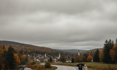
November is starting out on a crisp, frosty note across the Bennington Valley and the surrounding Green Mountains. Early morning temperatures in Bennington have dipped to a brisk 28.6°F with clear skies overhead and barely a breeze at just 1.4 mph. While you will definitely need a warm coat and a windshield scraper if you are heading out early, bright sunshine will help warm things up nicely as the day unfolds. We are expecting clear skies throughout Sunday, November 1, with daytime high temperatures topping out at 54.8°F. Overnight, temperatures will pull back down into freezing territory, settling around a low of 28.3°F. Precipitation chances remain virtually nonexistent today at just 1 percent, with 0 inches of rain expected and maximum wind speeds staying gentle at 7.6 mph.
Midweek Warm-Up Bringing Overcast Skies
As we move into the workweek, a noticeable shift in weather is on tap for southwestern Vermont. Clouds will move in, but conditions will remain completely dry and significantly milder than usual for early November. On Monday, November 2, expect overcast skies throughout the day with daytime temperatures rising to a warm high of 64.4°F. Overnight low temperatures on Monday will stay comfortably above freezing, dropping only to 46.9°F. Rain chances stay very low at 5 percent with 0 inches of precipitation expected and maximum winds reaching up to 8.3 mph.
Tuesday, November 3, maintains this mild and calm trend. Overcast conditions will persist across the region, keeping daytime high temperatures around 61.2°F and overnight low temperatures around 46.5°F. Wind speeds will remain light, maxing out at 4.8 mph, while precipitation probability stays at a low 3 percent with 0 inches of rain in the forecast.
Commute Impacts for US-7, VT-9, and VT-279
Commuters traveling along major local corridors such as US-7, VT-279, or climbing VT-9 (the Molly Stark Trail) up toward Woodford should take extra care early this morning. With current temperatures starting off at 28.6°F and overnight low targets down to 28.3°F, any lingering moisture on bridges, overpasses, or shaded mountain stretches could create isolated frost patches. However, dry conditions with 0 inches of rain expected across the entire three-day period mean roadways should remain dry once the morning chill burns off under the sun.
Light maximum winds—7.6 mph today, 8.3 mph Monday, and 4.8 mph Tuesday—mean no wind-related travel hazards are anticipated for commuters heading to North Bennington, Shaftsbury, Arlington, or down toward Pownal.
Outdoor Recreation and Seasonal Outlook
For outdoor enthusiasts planning a hike up Mount Anthony, a trail walk in the Green Mountain National Forest, or a trip around Lake Paran, Sunday offers the brightest conditions of the period. Highs near 54.8°F under clear skies make for comfortable late-fall hiking conditions as long as you layer up for the sub-freezing morning start. If you are heading outdoors on Monday or Tuesday, you will encounter overcast skies, but temperatures climbing to 64.4°F and 61.2°F will offer exceptionally mild weather for outdoor chores and trail walks.
Community and Household Tips
With morning frost on the ground and low temperatures dropping to 28.3°F early on, remember to check outdoor water hoses, protect sensitive plants, and ensure pets have warm, sheltered spaces. The rapid warm-up on Monday and Tuesday, where night lows remain around 46.9°F and 46.5°F, provides a welcome respite for heating budgets across Bennington County before late-fall cold settles back in. Checking on elderly neighbors during crisp morning freezes is always a great community practice.
Detailed Three-Day Outlook
- Sunday, November 1: Clear skies with a high of 54.8°F and a low of 28.3°F. Maximum winds of 7.6 mph; 1% chance of rain with 0 inches expected.
- Monday, November 2: Overcast skies with a high of 64.4°F and a low of 46.9°F. Maximum winds of 8.3 mph; 5% chance of rain with 0 inches expected.
- Tuesday, November 3: Overcast skies with a high of 61.2°F and a low of 46.5°F. Maximum winds of 4.8 mph; 3% chance of rain with 0 inches expected.
The Bottom Line
Bundle up for a frosty 28.6°F start this morning, but enjoy a clear, sunny Sunday high of 54.8°F. Expect cloud cover to increase over the next two days, but temperatures will climb into the low-to-mid 60s with zero rainfall expected, making for mild, dry conditions across Bennington County.
Weather data provided by Open-Meteo.
Related: Damp Late-August Stretch Brings Rain, Drizzle, and Cooler Temperatures to Bennington County
Related: Warm, Cloudier Pattern Sets In for Bennington County Before Weekend Drizzle and Cooler Air
Related: Bennington County Weather: Comfortable Late-Summer Days Ahead with Rain Chances by Midweek
Related: Border County Tax Pressures Mount as New York Shifts SNAP Costs
Related: Bennington Valley Weather: Warm August Days Ahead with Overcast Skies and Mild Nights
See a typo? Report it here.