Weather
Bennington County Forecast: Foggy Friday Warms to 71°F Before Weekend Cooling and Sunday Drizzle
Foggy Friday conditions across Bennington County will yield to a mild afternoon high near 71 degrees before a weekend cooldown. Saturday brings overcast skies in the lower 60s, followed by dense drizzle and chilly highs near 54 degrees on Sunday.


Last updated:
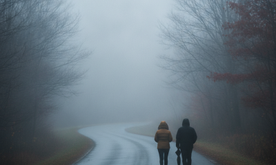
Bennington County weather forecast. A blanket of low valley fog is greeting residents across southwestern Vermont to wrap up the workweek. In Bennington, the temperature stands at 64.4°F with a light breeze of 5.8 mph, creating a damp, quiet start to the morning from Old Bennington and North Bennington out through Pownal and Shaftsbury. While early visibility is reduced, milder air is in place today before a noticeable cooldown arrives for the weekend, culminating in damp drizzle by Sunday.
Current Travel Conditions and Morning Commute
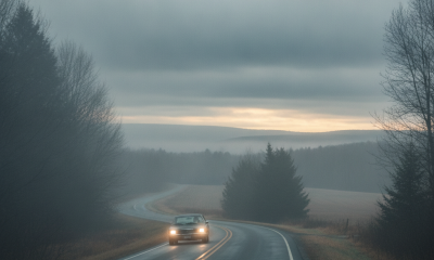
Drivers navigating the morning commute should plan for pockets of thick fog, particularly in low-lying spots and along river drainages. Travel on US-7 running north toward Arlington and south toward Pownal will require extra following distance and lower speeds through the early hours. Motorists connecting through the VT-279 bypass should also stay alert for sudden changes in visibility.
For those traveling east along Route 9—the Molly Stark Trail—up into the higher terrain toward Woodford, fog can remain persistent as moisture clings to the mountain slopes. Remember to keep headlights on low beam to avoid glare against the mist. The fog will be the primary travel concern for Friday, with maximum wind speeds expected to peak around 13.1 mph later in the day.
Three-Day Bennington County Weather Forecast
Bennington County Weather Forecast: Friday, September 18
Despite the overcast and foggy opening hours, Friday will be the warmest day of the forecast cycle. The afternoon high is expected to reach 71.3°F under lingering misty and foggy conditions. Precipitation will remain virtually absent, with zero measurable inches expected and just a slight 7 percent chance of a stray sprinkle. Winds will remain manageable, maxing out at 13.1 mph. By Friday night, temperatures will drop to an overnight low of 53°F, bringing comfortable, cool conditions to the valley.
Saturday, September 19: Overcast and Seasonably Crisp
Saturday brings a distinct transition to a cooler, autumn-like atmosphere. Skies will turn completely overcast across Bennington County, keeping daytime temperatures capped at a high of 62.1°F. It will be a calm day overall, with maximum winds dropping to a light 4.7 mph and precipitation chances falling to a negligible 1 percent with 0 inches of rain projected. Saturday evening will turn sharply chilly as the low settles down to 45.4°F, making it a night to close up windows and have a heavier blanket ready.
Sunday, September 20: Dense Drizzle and Chilly Highs
The weekend finishes on a noticeably damp and raw note. Dense drizzle will overspread the region, with the probability of precipitation climbing sharply to 87 percent. Total rainfall accumulation is projected at 0.24 inches. The damp air will hold temperatures down significantly, reaching a high of only 54.2°F before settling to an overnight low of 46.1°F. Peak winds will hover near 7.2 mph, adding a light bite to the cool, wet air.
Mountain Trails and Outdoor Recreation
Outdoor enthusiasts heading out to Mount Anthony, walking the paths around Lake Paran, or planning an outing into the Green Mountain National Forest should schedule the bulk of their outdoor activities for the first half of the weekend. Friday and Saturday will remain dry, offering decent conditions for walking and light hiking, though trails may carry leftover dampness and leaf litter that can be slick underfoot. By Sunday, the arrival of dense drizzle and temperatures struggling in the mid-50s will create wet, chilly footing on higher-elevation trails. If you are venturing outdoors on Sunday, waterproof shells and warm, non-cotton base layers will be necessary to stay comfortable in the persistent damp.
Community Care and Seasonal Context
With overnight temperatures dipping to 45.4°F on Saturday night and daytime readings stalling at 54.2°F in dense drizzle on Sunday, this weekend marks a clear step toward typical late-September chill. There are currently no active weather alerts, watches, or warnings in effect for Bennington County, but the damp cold on Sunday can be tough on vulnerable neighbors, older adults, and outdoor pets. Make sure animals have dry, sheltered spaces out of the drizzle, and consider checking in on friends or family who may be sensitive to rapid temperature shifts.
The Bottom Line
- Friday: Morning fog lifts to a mild high of 71.3°F; dry conditions with a low of 53°F tonight.
- Saturday: Overcast and cooler with a high of 62.1°F; a crisp overnight low of 45.4°F.
- Sunday: Raw and damp with dense drizzle, an 87 percent chance of rain (0.24 inches), and a high of just 54.2°F.
Weather data provided by Open-Meteo.
Related: Damp Late-August Stretch Brings Rain, Drizzle, and Cooler Temperatures to Bennington County
Related: Border County Tax Pressures Mount as New York Shifts SNAP Costs
Related: Warm, Cloudier Pattern Sets In for Bennington County Before Weekend Drizzle and Cooler Air
Related: Bennington County Weather: Comfortable Late-Summer Days Ahead with Rain Chances by Midweek
Related: Bennington 250 Announces ‘250 for 250’ Year-End Gala to Support Anniversary Celebrations
Related: Bennington Battle Day Marked as Historic Monument Awaits Repairs
See a typo? Report it here.