Weather
Bennington Weather: Chilly Overcast Weekend with Snow Flurries and Sub-Freezing Nights Ahead
Bennington County faces a chilly, overcast weekend with snow flurries and sub-freezing nights. Highs will reach the upper 30s to low 40s before dipping to 27.5 degrees Monday night. Drivers should watch for icy conditions on US-7 and VT-9.



Last updated:
Current Conditions in the Bennington Valley Bennington VT weather forecast
As we step outside across Bennington County today, conditions are cold and quiet. Currently, the temperature sits at 32.1°F under completely overcast skies, accompanied by a light wind hovering around 1.9 mph. Whether you are starting your morning in Old Bennington, commuting through North Bennington, or heading out along US-7, you will want to layer up for a brisk, overcast autumn stretch.
Saturday Forecast: Light Snow and Chilly Temperatures
For Saturday, November 14, 2026, expect a chilly day with slight snow showers in the area. Temperatures will top out at a modest high of 37.6°F before dropping to an overnight low of 31.6°F. We have a 46 percent chance of precipitation, with total liquid equivalent precipitation expected to reach roughly 0.073 inches. Maximum wind speeds will remain gentle to moderate, topping out around 9.7 mph.
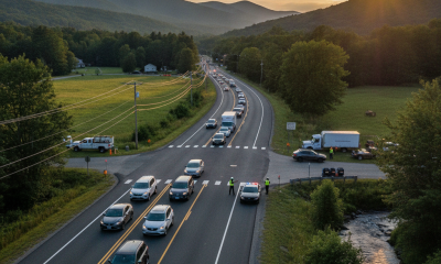
With daytime highs reaching 37.6°F and overnight lows dipping just below freezing at 31.6°F, drivers should stay mindful of potential black ice during early morning and late evening travel. Key corridor routes like US-7, the VT-279 bypass, and VT-9 (the Molly Stark Trail) leading up toward Woodford can develop slick spots where moisture collects on cooler pavement. If you are planning an outdoor excursion around Mount Anthony or the Green Mountain National Forest, pack moisture-resistant layers to stay comfortable in the cold, damp environment.
Sunday Forecast: Moderate Snow Flurries and Mild Daytime Highs
Heading into Sunday, November 15, 2026, conditions remain overcast with a forecast for moderate snow flurries. High temperatures will nudge slightly higher, reaching 40.4°F, while the overnight low settles around 32.5°F. Precipitation probability decreases to 22 percent, with light liquid accumulation forecasted at just 0.028 inches. Winds will peak at approximately 9.1 mph.
Although precipitation amounts are relatively light, the combination of moderate snow flurries and temperatures hovering near the freezing mark can make for tricky conditions on elevated roadways and shaded stretches in Shaftsbury, Pownal, and Arlington. If you plan to walk around Lake Paran or take a weekend hike, be prepared for brisk winds reaching up to 9.1 mph and damp trail conditions. The daytime high of 40.4°F will allow for minor melting during the afternoon hours, but temperatures holding near 32.5°F at night mean any lingering standing water could freeze.
Monday Forecast: Dry Skies and a Cold Nighttime Dip
The new workweek begins on Monday, November 16, 2026, with dry but persistently overcast conditions. High temperatures will once again top out at 40.4°F, matching Sunday’s high, but precipitation chances drop to 0 percent. Max wind speeds will soften to around 7.1 mph.
The main story for Monday comes after sunset. Temperatures will plummet to a clear low of 27.5°F, making it the coldest night of the three-day stretch. With temperatures dropping well into the upper 20s, any moisture left over on untreated roads, bridges, and sidewalks from weekend snow could freeze solid. Early morning commuters on Monday and Tuesday should watch for icy patches, particularly along elevation shifts near Woodford and higher terrain across the Green Mountains.
Community Safety, Outdoor Precautions, and Pet Care
With temperatures consistently dipping to 31.6°F on Saturday, 32.5°F on Sunday, and down to 27.5°F on Monday night, winter weather precautions are essential for all local residents:
- Driving Safety: Watch for sudden ice patches on bridges and overpasses along US-7 and VT-279, especially during early morning commutes when temperatures are near or below freezing.
- Pet Care: As overnight temperatures fall to 27.5°F on Monday, ensure outdoor pets have warm, dry shelter or bring them indoors. Limit prolonged outdoor exposure for sensitive animals.
- Neighborly Checks: Take a moment to check in on elderly neighbors or vulnerable community members to ensure their heating systems are working properly as temperatures drop into the 20s.
- Outdoor Recreation: Hikers venturing into the Green Mountain National Forest or climbing Mount Anthony should prepare for damp, cold, and cloudy conditions with max winds up to 9.7 mph. Dress in synthetic layers rather than cotton to stay warm.
The Bottom Line
Here is your quick planning guide for the days ahead in Bennington County:
- Saturday, Nov 14: High 37.6°F, Low 31.6°F. 46% chance of slight snow (0.073 in precip). Winds up to 9.7 mph. Slippery roads possible.
- Sunday, Nov 15: High 40.4°F, Low 32.5°F. 22% chance of moderate snow flurries (0.028 in precip). Winds up to 9.1 mph. Overcast and chilly.
- Monday, Nov 16: High 40.4°F, Low 27.5°F. 0% precip, overcast. Winds up to 7.1 mph. Coldest night ahead—watch for frozen pavement.
Weather data provided by Open-Meteo.
Related: Damp Late-August Stretch Brings Rain, Drizzle, and Cooler Temperatures to Bennington County
Related: Warm, Cloudier Pattern Sets In for Bennington County Before Weekend Drizzle and Cooler Air
Related: Bennington County Weather: Comfortable Late-Summer Days Ahead with Rain Chances by Midweek
Related: Border County Tax Pressures Mount as New York Shifts SNAP Costs