Weather
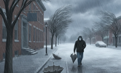
Heavy Rain and Strong Winds Hit Bennington Today Ahead of a Weekend Hard Freeze
Bennington County faces heavy rain over an inch today ahead of a sharp weekend cold front. Temperatures will plunge into the upper 20s and low 30s Saturday and Sunday night, bringing the region’s first hard freeze.

About Bennington VT weather forecast

Last updated:
Good day, Bennington County! Whether you are heading out for your morning commute, tending to late-season chores in the garden, or making plans for the weekend, today brings a significant shift in our autumn weather pattern across southwestern Vermont. Currently, conditions in the Bennington area are overcast with a temperature of 53.5°F and a sustained breeze blowing at 17.2 mph. A heavy rain system is pushing into the region today, bringing substantial rainfall and mild temperatures, followed by a dramatic weekend cool-down that will plunge overnight temperatures well below the freezing mark across the Bennington Valley and surrounding mountain towns.
Today’s Forecast: Heavy Rain and Mild Temperatures
For Friday, October 16, expect rain to be heavy at times throughout the day, with a precipitation probability standing high at 89 percent. Total rainfall accumulation is expected to reach 1.062 inches before tapering off tonight. Despite the wet weather, temperatures will feel unseasonably mild, climbing to a afternoon high of 67.4°F. Winds will remain blustery, topping out with maximum gusts around 18 mph. As the rain system moves out later tonight, temperatures will begin their drop, falling to an overnight low of 45.8°F.
Weekend Outlook: Turning Sharply Cooler with Sub-Freezing Lows
As we head into the weekend, the atmospheric setup shifts dramatically as cooler, drier air pushes into Bennington, Shaftsbury, Pownal, and Arlington.
- Saturday, October 17: Clouds will linger across the region, keeping conditions overcast throughout the day. High temperatures will top out at a chilly 50.9°F, accompanied by a maximum wind speed of 15.8 mph. Rain chances drop off drastically to just 7 percent with no measurable precipitation expected (0 inches). The main story on Saturday will be the arrival of the cold air overnight, as temperatures plunge to a freezing low of 31.1°F.
- Sunday, October 18: High pressure takes control, clearing out the lingering cloud cover to deliver a beautiful, clear sky day across southwestern Vermont. Highs will again be crisp, reaching 50.8°F. Winds will calm significantly, reaching a light maximum speed of only 4.3 mph. Under clear skies and light winds, radiation cooling will drop nighttime temperatures to an even colder low of 29.2°F—a true hard freeze for the valley.
Commute & Travel Impacts Across Southwestern Vermont
With over an inch of rain (1.062 inches) forecast for today, drivers along major corridors such as US-7, VT-279, and VT-9 (the Molly Stark Trail) should prepare for standing water, localized ponding, and spraying from heavy traffic. The combination of heavy rain and fallen leaves will make roadways slick, particularly through shaded winding curves around Old Bennington and North Bennington.
Drivers traveling east over the Woodford Notch on VT-9 should exercise extra caution where mountain runoff can pool on the asphalt. While freezing temperatures are not a concern during today’s high of 67.4°F, keep in mind that any lingering damp patches or runoff spots on high-elevation roads could freeze as temperatures drop down to 31.1°F Saturday night and 29.2°F Sunday night.
Outdoor Recreation and High-Elevation Conditions
Outdoor enthusiasts planning activities around Mount Anthony, the Green Mountain National Forest, or Lake Paran should plan accordingly:
- Friday: Rainy and windy conditions make hiking or boating unfavorable. Heavy rain and winds peaking at 18 mph will create soggy trails and slick rock surfaces along high-elevation ridge lines.
- Saturday: Trail conditions will begin drying out under overcast skies, but expect chilly air with highs near 50.9°F and breeze peaking at 15.8 mph.
- Sunday: Sunday offers by far the best outdoor weather of the stretch. Clear skies and gentle winds around 4.3 mph will make for crisp, scenic autumn hikes, though you will want to dress in warm layers.
Seasonal Context: Preparing for the Freeze
This weekend brings our first major hard freeze of the season with consecutive nights reaching 31.1°F and 29.2°F. Vermonters should take immediate steps to protect sensitive outdoor vegetation, complete final harvest tasks in home gardens, and disconnect and drain garden hoses to prevent pipe damage. Ensure heat systems are working smoothly, bring outdoor pets indoors during these cold overnight stretches, and take a moment to check in on vulnerable neighbors as winter air makes its initial push into the region.
The Bottom Line
Grab the heavy rain gear today for a wet, mild 67.4°F afternoon with over an inch of rain. Transition to warm winter layers for the weekend, as clouds clear out by Sunday, giving way to bright sunshine, daytime highs around 50°F, and cold overnight temperatures dipping down to a freezing 29.2°F.
Weather data provided by Open-Meteo.
Related: Damp Late-August Stretch Brings Rain, Drizzle, and Cooler Temperatures to Bennington County
Related: Warm, Cloudier Pattern Sets In for Bennington County Before Weekend Drizzle and Cooler Air
Related: Bennington County Weather: Comfortable Late-Summer Days Ahead with Rain Chances by Midweek
Related: Border County Tax Pressures Mount as New York Shifts SNAP Costs
Related: Bennington County Weather: Drizzle Today Ahead of Overcast Skies and a Cool Weekend Drop
See a typo? Report it here.